historic viticultural map of the Mosel
region of Koblenz with middle and lower Mosel
18,50 €
incl. 19% VAT plus shipping costs
8 in stock
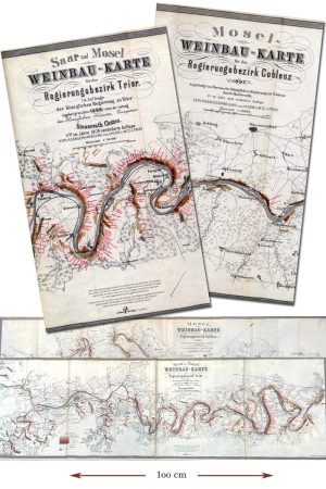
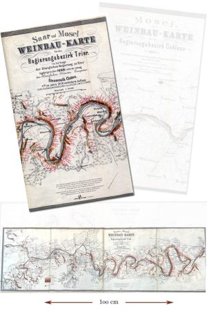
The version of the viticultural map of the Mosel that appeared in 1897 was crucial in advancing the region’s reputation. The publication of the map followed a decades-long effort to establish a more equitable tax structure for the Mosel’s vineyards and winemakers. For that system’s creation, all vineyards were divided into one of eight classes based upon net profit.
For the clarity of the published map, the eight classes were reduced to three, each a different shade of red, and clear, legible site names were attached.
- 1 map, dimension (W x H in cm): 100 x 30
Categories